

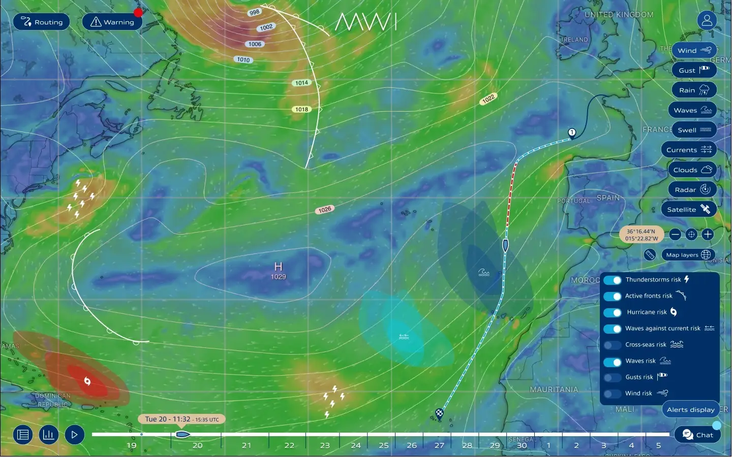
Marine Weather Intelligence has successfully completed its ESA Kick-Start feasibility study on HWZSea, a next-generation maritime early-warning concept designed to enhance operational safety in demanding offshore and shipping environments.
ESA Kick-Start project conclusion, HWZSea
Marine Weather Intelligence has successfully completed its ESA Kick-Start feasibility study focused on HWZSea, an advanced maritime early-warning concept designed to enhance operational safety at sea.
Supported by the European Space Agency, the project assessed how space-based data could strengthen short-term hazard anticipation in demanding offshore and shipping environments.
What was the goal?
The primary objective of the HWZSea study was to evaluate the feasibility of a next-generation maritime warning service capable of improving the detection and anticipation of hazardous weather phenomena at sea.
The project focused on:
- Enhancing short-term risk anticipation for vessels
- Reducing exposure to sudden, high-impact weather events
- Supporting safer operational decision-making
- Assessing the technical and commercial viability of a scalable early-warning service
The study specifically addressed meteorological situations difficult to anticipate with traditional forecasting, but with significant operational and financial consequences.
Who is it designed for?
HWZSea targets high-value maritime operations where safety, reliability, and timing are critical:
- Commercial shipping operators
- Offshore energy companies
- Complex maritime transport projects
- Cruise and ferry operators
- Marine warranty surveyors and insurers
How does it work?
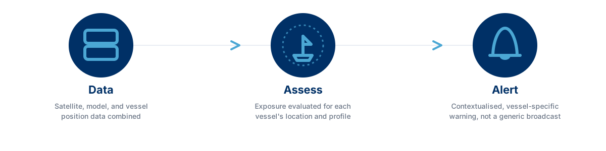
The system combines multiple data sources into a unified maritime decision-support framework. Various inputs are analysed to generate vessel-specific hazard insights and contextualised alerts.
Rather than broadcasting generic warnings, it evaluates exposure relative to each vessel’s location and operational profile, providing actionable, operationally relevant information.
Examples of hazardous weather zones include weather front detection and thunderstorm nowcasting.
Why generic warnings fall short
A weather warning broadcast to an entire zone treats every vessel inside it the same way, regardless of where exactly they sit relative to the hazard or what kind of operation they’re running. A vessel skirting the edge of a zone and a vessel crossing straight through its centre face very different levels of real risk, yet a generic broadcast gives them the same message.
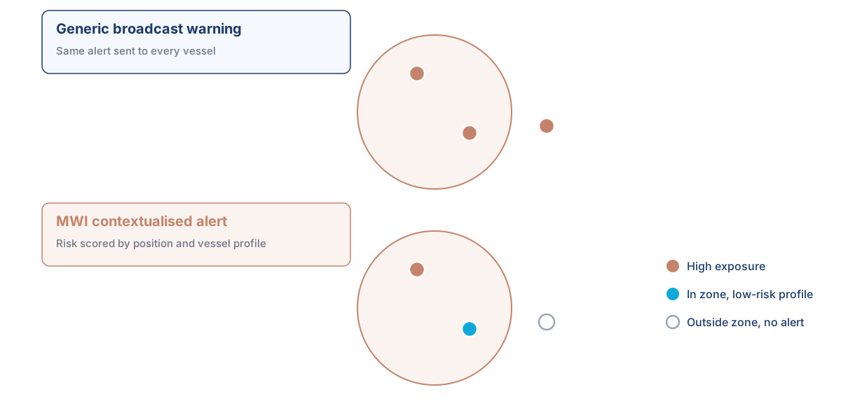
By scoring exposure per vessel rather than per zone, HWZSea is designed to tell an operator not just that a hazard exists, but whether it actually concerns their vessel, and how urgently.
The added value of space data
Satellite data provides several key advantages:
- Wide-area, continuous monitoring over oceanic regions
- High temporal resolution for near-real-time tracking
- Independent observation beyond ground-based networks
The collaboration with ESA ensured access to high-quality satellite data streams and technical validation within a structured innovation framework.
What’s next?
The feasibility study confirmed the technical relevance and operational interest of the HWZSea concept. HWZSea represents a foundational step toward more resilient, data-enhanced maritime operations, and a key milestone in Marine Weather Intelligence’s R&D roadmap.
Conclusion
A hazard broadcast to an entire zone is only ever a rough proxy for the risk a specific vessel actually faces. HWZSea’s feasibility study confirmed that combining satellite data with a vessel-specific exposure assessment can turn that rough proxy into a contextualised, actionable alert, telling an operator not just that a hazard exists, but whether it concerns them.
Backed by the European Space Agency and validated as technically and operationally sound, HWZSea marks a foundational step in Marine Weather Intelligence’s R&D roadmap toward early-warning services built around the vessel, not just the zone.