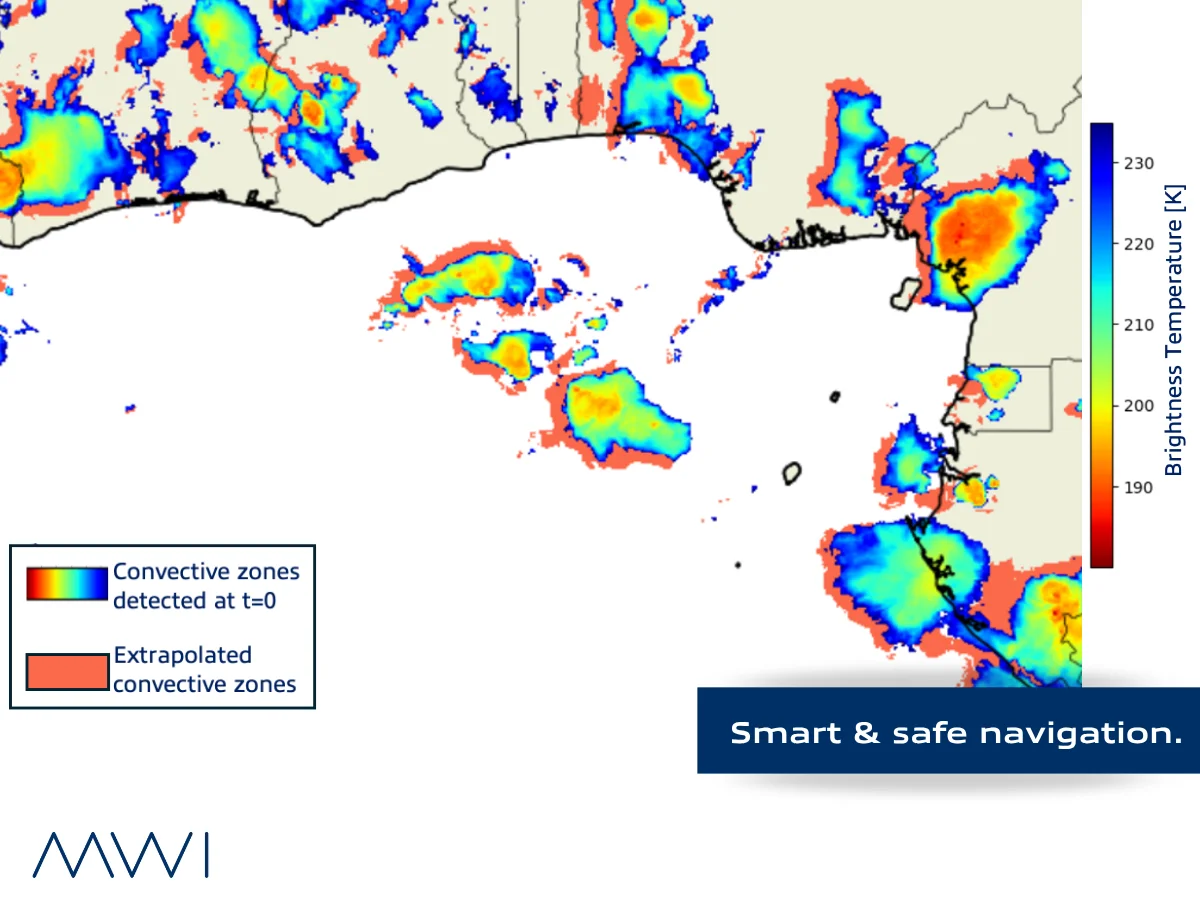
Conventional weather forecasts miss localised convective events. Marine Weather Intelligence is developing a satellite-based nowcasting system to provide a 30–90 minute alert window for offshore teams operating in storm-prone regions.
The core challenge
At sea, thunderstorms demand rapid decision-making and precise forecasting. This is particularly critical in storm-prone regions like the Gulf of Guinea, where the Intertropical Convergence Zone and warm ocean waters create conditions for sudden, high-intensity convective storms. For offshore heavy lift operations, accurate storm prediction is essential for safety and timing.
Technology approach
The proof of concept leverages satellite-based infrared imagery to detect convective zones as they form. The system applies optical flow techniques to track cloud-top temperature changes, which indicate thunderstorm growth and movement.
Rather than relying on broad numerical weather prediction models, the system focuses on the fine-scale storm activity that directly impacts offshore operations.
The solution delivers short-range forecasts tailored to clients’ operational areas, providing critical lead time for risk mitigation.
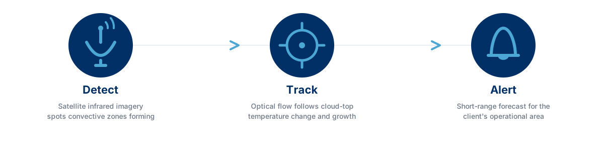
The three stages run continuously rather than as a single forecast issued once per cycle: as the satellite feed updates, the system re-detects, re-tracks, and re-issues its short-range forecast, so the alert window keeps pace with the storm as it evolves.
Operational benefits
The nowcasting system is designed to empower offshore teams to:
- Adjust or postpone sensitive marine operations ahead of storm arrival
- Reroute vessels to safer waters with sufficient lead time
- Implement safety protocols with greater confidence and less uncertainty
Why conventional forecasts fall short
Most global weather models operate at resolutions too coarse to capture localised convective events. A squall cell can develop, intensify, and dissipate within a few hours, often within the gaps of model update cycles.
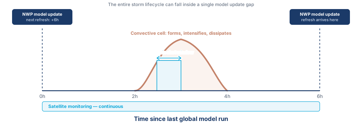
The diagram above illustrates the blind spot: a global model refreshed every six hours has no way to see a cell that forms, peaks, and dissipates between two runs. By the time the next run arrives, the storm the vessel actually sailed through is already history to the model.
“Instead of relying on broad forecasts, we focus on the fine-scale storm activity that directly impacts offshore operations.”
Satellite imagery provides continuous, wide-area monitoring that bridges this gap, particularly in oceanic regions with limited ground-based observational infrastructure.
Thunderstorm nowcasting across Marine Weather Intelligence’s operations
MWI Yachts
A 30-90 minute alert window is enough time to reef down, adjust a race strategy, or steer around a developing cell rather than sailing straight into it, particularly valuable in trade wind squalls and other fast-forming tropical convection.
MWI Shipping
Port approaches, pilotage, and cargo transfers can be sequenced around an incoming cell instead of interrupted by one, keeping schedules predictable in storm-prone regions like the Gulf of Guinea.
MWI Offshore Energies
Lifting, transfer, and other weather-sensitive operations depend on a stable window. Advance notice of a forming cell supports a safer go/no-go call than waiting for the storm to show up on standard forecasts.
Conclusion
Thunderstorm nowcasting closes a gap that broad numerical weather models cannot: the few hours it takes a convective cell to form, peak, and dissipate, often between one model update and the next. By tracking storms directly from satellite imagery rather than waiting on a model’s guess of where one might form, Marine Weather Intelligence gives offshore teams a genuine lead time, 30 to 90 minutes, to adjust course, delay an operation, or brace for what is coming.