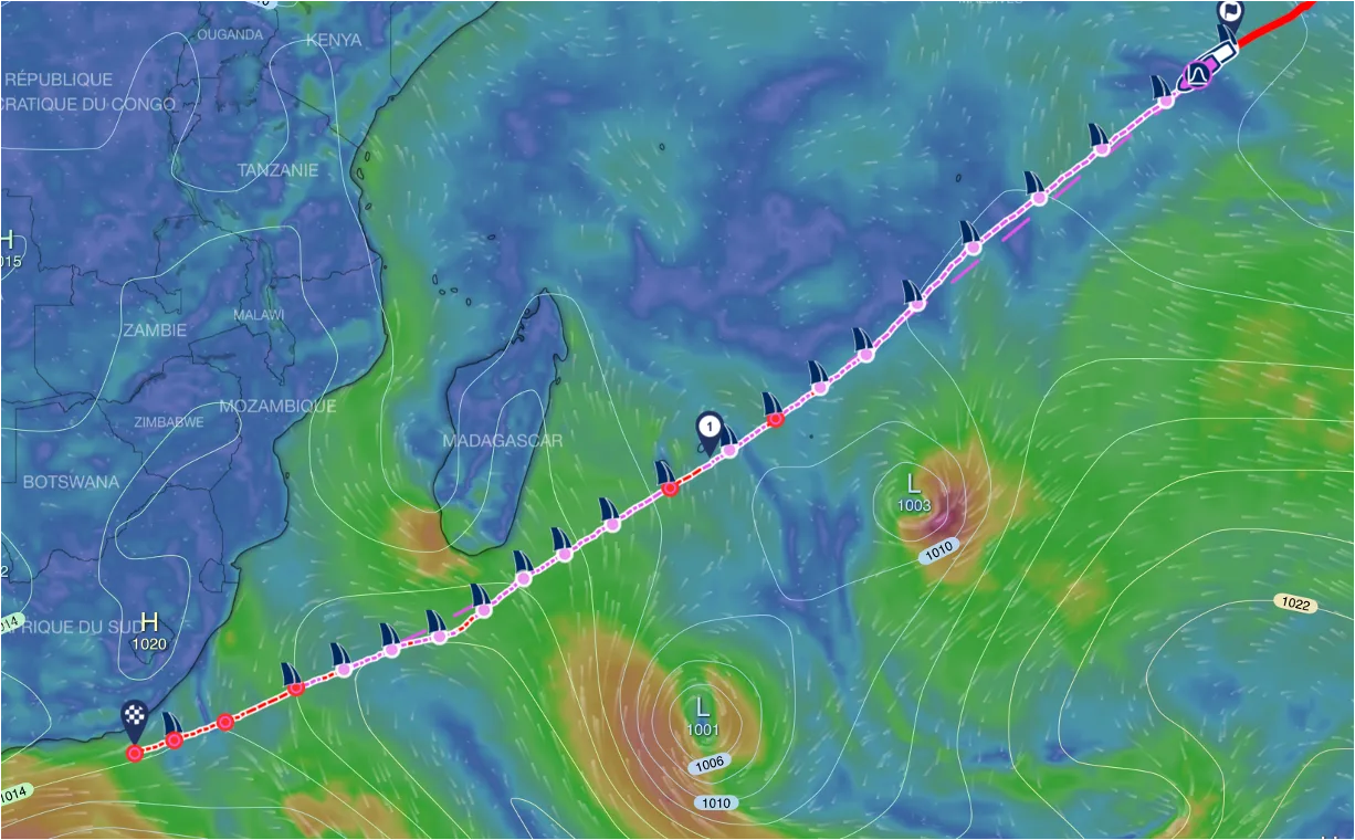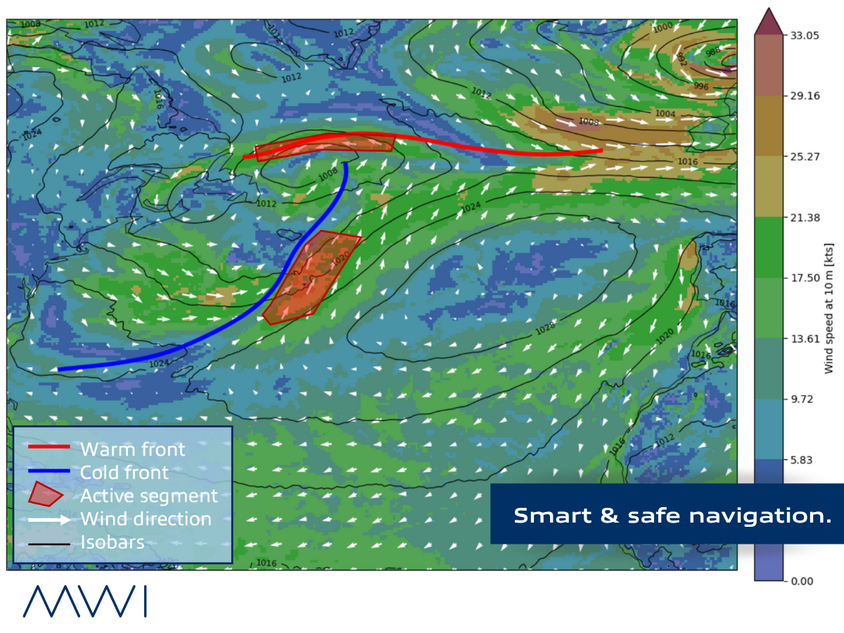
Fronts refer to boundaries separating air masses with contrasting temperature, moisture, and pressure. Sudden wind shifts, cross seas, strong gusts, heavy rain or thunderstorms — this zone is highly prone to accidents. Accurately identifying fronts and precisely anticipating their time of passage plays a key role in significantly improving safety at sea.
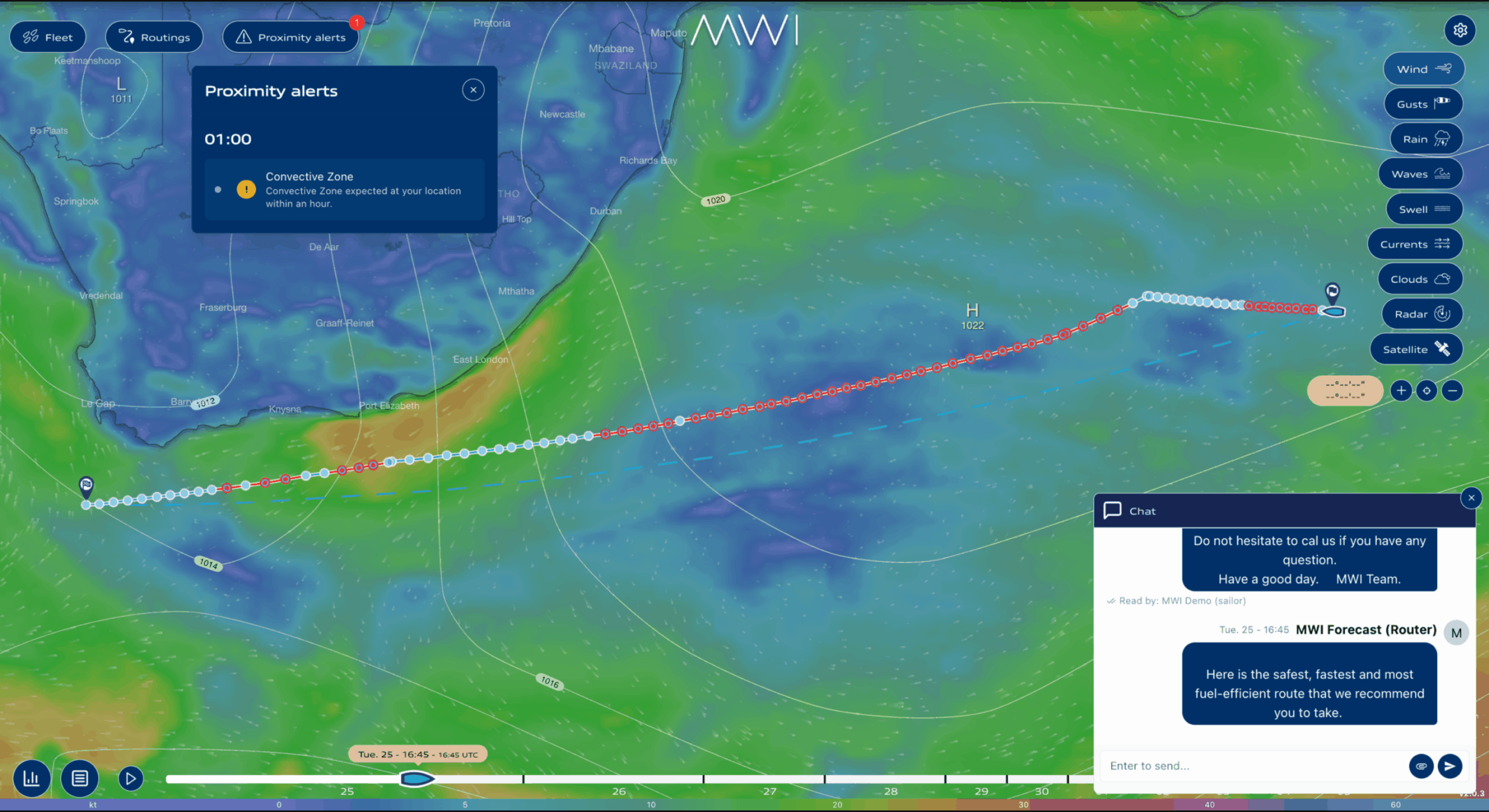
At MWI, we focus on detecting and analysing these critical areas to support safer, more efficient navigation.
We’ve developed a method that combines the Thermal Front Parameter (TFP) with machine learning, helping identify and visualise the most active, potentially hazardous parts of a front. Today, many maritime zones no longer have available weather front charts.
Tested during the 2024 Vendée Globe, our approach is already showing promising results in real-world conditions.
Smart & safe navigation.
Stay connected via our website and follow us on LinkedIn, Instagram & Facebook.